Cartography and geoinformatics specialists are engaged in geospatial activities, which is understood as the entire spectrum of work related to solving diverse problems and automating production processes that have a spatial component, based on geoknowledge obtained and used with the help of the most modern end-to-end technologies of the digital economy
The training program "Cartography and Geoinformatics" combines two important areas of knowledge - cartography and geoinformatics. Cartography is a field of activity that deals with the theory, methodology, creation and use of both classical geographical maps and zoological, climatic, historical, military, economic, geological and other types of maps. Geoinformatics is a field of activity on the design, creation, operation and use of geographic information systems (GIS) and their practical application and implementation.
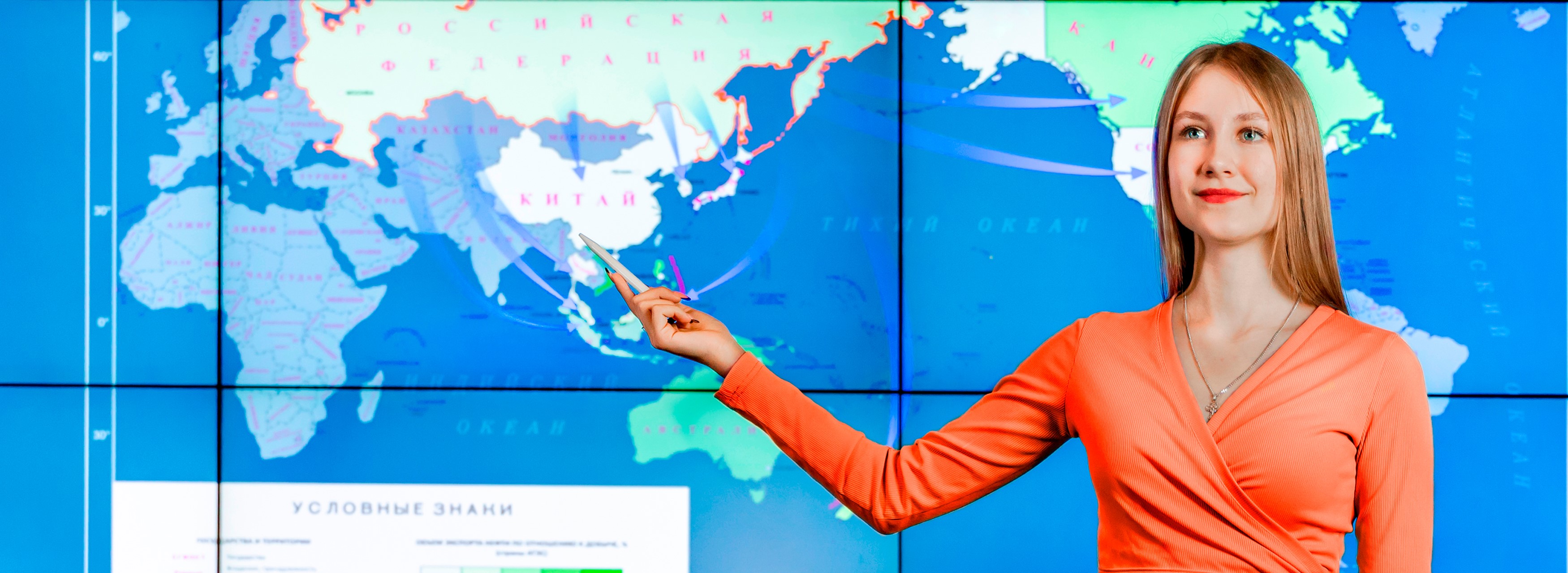
A modern cartographer uses a GIS in his work, which receives data collected by specialists from all over the world. Nowadays, electronic (digital) maps are becoming more and more widespread. Unlike paper maps, they can be regularly updated in accordance with new data. They can provide not only information about the earth's surface, but also often contain additional reference information.
The program is aimed at training specialists in the field of creating and using GIS, cartography and remote sensing. The main objective of the program is to train modern specialists ready to perform tasks related to the development and use of software and hardware for the geospatial industry, data and knowledge storage systems, geoportals and geoinformation models, mobile applications.
To automate information processes, the program includes the study of modern domestic and foreign software products: QGIS, PostgreSQL, PostGIS, pgAdmin, etc.
The profile includes the study of technologies for the development and design of cartographic works in analog and digital forms and GIS, spatial data bases and banks, multimedia technologies, virtual and augmented reality tools.
The profile is aimed at acquiring skills in the use of Earth remote sensing data for geoinformation monitoring of territories, visualization, publication and publishing of geoinformation.
Duration of full-time study - 4 years
Duration of study by correspondence - 5 years
The program includes educational and industrial practice, including the acquisition of skills in creating cartographic and geoinformation products (works), spatial databases, and the use of GIS and geoportals.
To master practical skills, the technological base of the research laboratories of SSUGT is used, including the Research Laboratory “Thematic Mapping” and the Research Laboratory “Satellite Monitoring of the Earth”.
Industrial practice takes place at leading industry companies in production conditions with direct participation of students in solving practical problems. The experience gained and the collected production material will allow you to prepare your final qualifying work, and also contribute to further employment in these organizations.
Cartographers may work in a variety of fields and organizations where maps need to be created, analyzed, or interpreted, including government agencies and authorities, private mapping companies, GIS development and maintenance companies, and research institutions.
Graduates are in demand in various fields of activity: oil and gas and mining industries, tourism, urban development and territorial planning, in the agricultural sector, in the field of ecology, transport, aviation and navigation, as well as in military structures.
SGUGT closely cooperates with the largest companies in Russia, such as: PPK Roskadastr, State Corporation Roscosmos, 2GIS, GBU NSO Geofond NSO, JSC PO Inzhgeodeziya, SCANEX Group of Companies, OJSC SIB-GEO-MAR, LLC NPO Ecological Safety, LLC Sibecoaudit, JSC SNIIGGiMS, Branch of the Federal State Budgetary Institution Roslesinforg Zapsiblesproekt, SC FGBU Research Center Planeta, LLC Data East, LLC SIBGAIK, LLC Geocad Plus, etc.